")
Survey Drafting Using Civil CADD: Building Accurate Engineering Maps for the Future
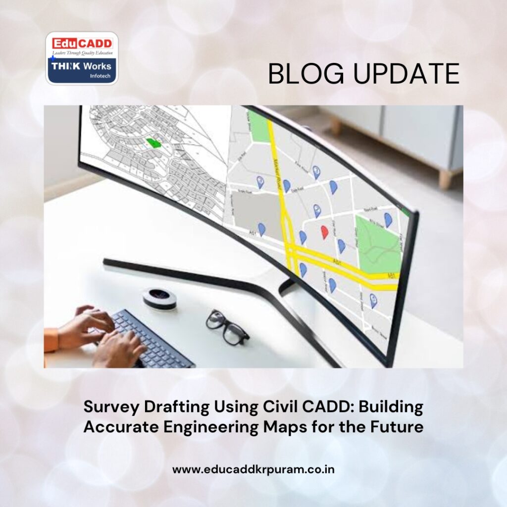
The success of every civil engineering and infrastructure project begins with precise site information. Whether it is a residential township, highway corridor, industrial facility, or urban development project, engineers need reliable data to make informed decisions. This is where Survey Drafting Civil CADD becomes an essential part of the planning and design process. Survey drafting transforms raw field measurements into detailed technical drawings that clearly represent land features, boundaries, elevations, utilities, and other critical site elements. These drawings serve as the foundation for engineering analysis, design development, and construction execution.
Survey Drafting Civil CADD
With the advancement of digital technologies, Civil CADD has dramatically changed the way survey drawings are prepared. Instead of relying on manual drafting methods, professionals can now create highly accurate maps and layouts using intelligent software tools. This digital transformation improves efficiency, reduces drafting errors, and enhances collaboration among project stakeholders. As infrastructure projects become more sophisticated and data-driven, Survey Drafting Using Civil CADD continues to play a vital role in ensuring successful project outcomes across various sectors.
Understanding the Purpose of Survey Drafting
Survey Drafting Civil CADD is the process of converting survey observations and field measurements into graphical representations that can be used by engineers, planners, architects, and contractors. These drawings provide a visual understanding of the physical characteristics of a site and help professionals evaluate existing conditions before beginning design activities.
Every construction project requires accurate site information to avoid costly mistakes during development. Survey drawings display important details such as land contours, property boundaries, structures, roads, water bodies, and utility networks. Through Survey Drafting Using Civil CADD, professionals can organize this information in a structured format that supports planning, design, and execution activities. As a result, project teams gain a clear understanding of site conditions and can make better decisions throughout the project lifecycle.
Evolution from Manual Drafting to Digital Survey Mapping
Survey Drafting Civil CADD has undergone significant changes over the past few decades. In earlier years, draftsmen relied on drawing boards, scales, templates, and manual calculations to prepare survey maps. Although these methods were effective for their time, they often required extensive labor and were susceptible to human errors.
The introduction of computer-aided drafting technologies revolutionized the industry by enabling faster and more accurate drawing preparation. Survey Drafting Using Civil CADD allows professionals to create, edit, and manage survey drawings digitally. Changes can be implemented quickly without redrawing entire plans. Furthermore, digital files can be stored, shared, and updated efficiently, making project coordination much easier. This transition from manual processes to intelligent software solutions has significantly improved productivity across the surveying and engineering sectors.
Role of Civil CADD in Modern Surveying Projects
Civil CADD serves as a specialized platform designed to support engineering drafting and survey mapping activities. The software provides tools that simplify the creation of detailed survey drawings while maintaining precision and consistency. Engineers and surveyors use Civil CADD to process field data and generate professional-quality maps that comply with industry standards.
One of the key advantages of Survey Drafting Civil CADD is the ability to handle large volumes of survey information efficiently. The software supports coordinate-based drafting, layer management, dimensioning, annotation, contour generation, and drawing customization. These capabilities allow users to represent complex site conditions accurately while maintaining organized project documentation. Consequently, Civil CADD has become a preferred solution for survey drafting professionals across various industries.
Field Data Collection and Its Importance
The quality of a survey drawing depends heavily on the accuracy of the field data collected during surveying operations. Modern surveyors use advanced equipment to gather precise measurements of land features and site conditions. These measurements serve as the foundation for all subsequent drafting activities.
Several technologies contribute to accurate data collection:
- Total Stations for measuring angles and distances.
- GPS systems for determining geographic coordinates.
- Drone surveys for aerial mapping and site imaging.
- Laser scanners for capturing highly detailed terrain information.
Once collected, this data is transferred into Civil CADD software for processing and drafting. Accurate field measurements ensure that survey drawings reflect real-world conditions, reducing the risk of design errors and construction conflicts.
Topographical Survey Drafting and Terrain Representation
Topographical surveys are among the most common applications of Survey Drafting Civil CADD. These surveys capture both natural and man-made features present on a site, providing valuable information for planning and design purposes. Topographical drawings typically include contours, elevations, vegetation, buildings, roads, drainage systems, and utility infrastructure.
Civil CADD enables users to process elevation data and create contour maps that illustrate changes in terrain. These maps help engineers evaluate slopes, identify drainage patterns, and assess site suitability for development. Furthermore, topographical drawings support environmental studies and infrastructure planning activities. By presenting terrain information in a clear visual format, survey drafting contributes significantly to effective project decision-making.
Property Boundary Mapping and Land Development
Property ownership and land development activities rely heavily on accurate boundary surveys. Establishing legal property limits is essential for preventing disputes and ensuring compliance with regulatory requirements. Survey Drafting Using Civil CADD simplifies the creation of boundary maps by accurately representing property lines, corner markers, easements, and rights-of-way.
Developers use these drawings to plan subdivisions, allocate land parcels, and prepare approval documents for authorities. Additionally, boundary maps support real estate transactions and legal documentation processes. The precision offered by Civil CADD helps surveyors maintain accuracy while preparing professional-quality plans. Consequently, property boundary drafting remains a critical component of land development projects.
Survey Drafting for Road and Highway Projects
Transportation infrastructure projects require detailed survey information to support design and construction activities. Roads, highways, flyovers, and transportation corridors depend on accurate mapping of existing site conditions. Survey Drafting Using Civil CADD plays a central role in preparing the drawings needed for these projects.
Surveyors collect information related to terrain elevations, existing roads, drainage structures, and surrounding land features. Engineers then use this data to design alignments, profiles, and cross-sections. Civil CADD facilitates the creation of these drawings while ensuring consistency across project documents. As a result, transportation projects benefit from improved planning accuracy and smoother construction execution.
Utility Mapping and Underground Infrastructure Planning
Modern cities depend on extensive utility networks that deliver essential services such as water, electricity, telecommunications, gas, and sewage management. Accurate utility mapping is necessary to avoid conflicts during construction and maintenance activities. Survey Drafting Using Civil CADD supports the preparation of detailed utility maps that display the location of underground and above-ground infrastructure.
These drawings assist engineers in planning utility installations and identifying potential clashes with existing systems. Furthermore, utility maps improve maintenance efficiency by providing accurate records of infrastructure locations. As urban development continues to expand, utility survey drafting becomes increasingly important for sustainable city planning and infrastructure management.
Contour Generation and Earthwork Analysis
One of the most valuable features of Civil CADD is its ability to generate contour maps automatically from elevation data. Contours provide a graphical representation of terrain variations and are essential for site grading, drainage design, and earthwork calculations. Survey Drafting Civil CADD simplifies contour generation while ensuring high levels of accuracy.
Engineers use contour maps to estimate excavation and filling requirements, evaluate site slopes, and design grading plans. These analyses help optimize construction activities and reduce project costs. Additionally, contour-based studies support environmental assessments and land development planning. The ability to create accurate terrain models quickly makes Civil CADD a powerful tool for engineering professionals.
Benefits of Using Civil CADD for Survey Drafting
The adoption of Civil CADD technology offers numerous advantages compared to traditional drafting methods. One of the most significant benefits is increased efficiency. Tasks that once required days of manual effort can now be completed within hours using automated tools and workflows.
Additional benefits include:
- Improved drafting accuracy and consistency.
- Faster revisions and design updates.
- Better project documentation and record management.
- Enhanced collaboration among project teams.
These advantages contribute directly to higher productivity and reduced operational costs. Consequently, organizations that implement Survey Drafting Using Civil CADD gain substantial improvements in project delivery and quality control.
Enhancing Collaboration Through Digital Survey Drawings
Construction and infrastructure projects involve multiple stakeholders, including surveyors, engineers, architects, contractors, consultants, and regulatory authorities. Effective communication among these groups is essential for project success. Survey Drafting Using Civil CADD facilitates collaboration by providing standardized digital drawings that can be shared easily across teams.
Digital survey files allow stakeholders to review project information, provide feedback, and coordinate design decisions efficiently. Furthermore, cloud-based collaboration tools enable real-time access to updated drawings regardless of location. This improved communication reduces misunderstandings and helps maintain project schedules. As projects become increasingly collaborative, digital survey drafting continues to strengthen coordination across multidisciplinary teams.
Career Opportunities in Survey Drafting and Civil CADD
The growing demand for infrastructure development has created numerous career opportunities for professionals skilled in Survey Drafting Civil CADD software. Organizations across construction, engineering, transportation, and land development sectors actively seek qualified individuals who can prepare accurate survey drawings and manage digital mapping data.
Popular career roles include Survey Draftsman, CAD Technician, Survey Coordinator, Infrastructure Drafting Specialist, GIS Technician, and Civil Design Assistant. Professionals with expertise in Survey Drafting Using Civil CADD often enjoy strong career growth prospects due to the increasing reliance on digital technologies. Additionally, specialized training and certifications can further enhance employment opportunities and earning potential within the industry.
Future Trends Shaping Survey Drafting Technology
Technological innovation continues to influence the future of surveying and drafting. Emerging solutions such as drone mapping, artificial intelligence, cloud computing, and Building Information Modeling are transforming traditional workflows. These technologies are making Survey Drafting Using Civil CADD more efficient, accurate, and integrated than ever before.
Artificial intelligence is beginning to automate data processing and quality control tasks, reducing manual effort and improving consistency. Drone technology enables rapid data collection across large project sites. Meanwhile, cloud-based platforms support seamless collaboration among geographically dispersed teams. As these innovations continue to evolve, survey drafting professionals will gain access to even more powerful tools for managing complex engineering projects.
Conclusion
Survey Drafting Civil CADD has become a cornerstone of modern engineering and infrastructure development. By converting field survey data into precise digital drawings, Civil CADD enables professionals to plan projects with greater confidence and accuracy. From topographical mapping and boundary surveys to transportation planning and utility management, survey drafting supports every stage of the project lifecycle.
As the construction industry embraces digital transformation, the importance of Civil CADD continues to grow. Its ability to improve productivity, enhance accuracy, and streamline collaboration makes it an invaluable tool for engineering professionals. Individuals who develop expertise in Survey Drafting Using Civil CADD position themselves at the forefront of modern infrastructure development and contribute significantly to the successful execution of complex projects worldwide.

